The Angle to the 10th Match
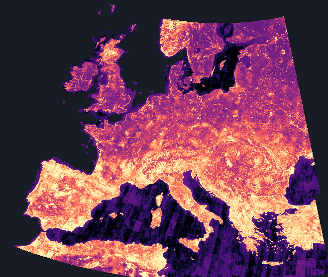
Every card on this site measures resemblance as the angle between two embeddings (the first card explains why). To score how unusual a place is, take its 10 closest matches anywhere in Europe and read the angle to the 10th. Matches within about 100 km do not count, or every place would match the fields next door.
For a typical place, all 10 look-alikes lie within about 10°. The flank of Etna has none closer than 41.8°. The score uses the 10th match rather than the first, so one lucky match cannot make a place look ordinary.
Each Stop's Few Relatives
The map is coloured by the share of Europe each place is more unusual than. At each stop of the tour it recolours by how closely every other cell resembles that stop, so the few places that come anywhere near it light up.
How this was made
The scores come from AlphaEarth Foundations' 2018 embedding, averaged to the 6 km grid. Across 236,820 cells, the most unusual is 43.7° from its 10th match. The most average place, the cell nearest Europe's mean direction, is 27.2° from that mean.
The disc's radius of 17 grid cells approximates a chosen scale of 100 km, not a measured one. Similarity keeps falling with distance as far as the card can measure (by 2.76° per 100 km at the far end of the range), so a different radius would reorder the close calls. The tour keeps one stop per disc and skips North Africa, which the grid reaches at its southern edge. Each stop is named for the feature OpenStreetMap records there, and the line on why it stands out is a hypothesis about the ground, not something the embeddings report.
Berlin is held out in this project, so no place near it is ranked. When an earlier data defect was fixed, a cell's nearest neighbour changed for 27.6% of 239,827 cells in a full-scale check on the 2024 layer, so a close call in the ranking can go either way. Place names: GeoNames, CC-BY.