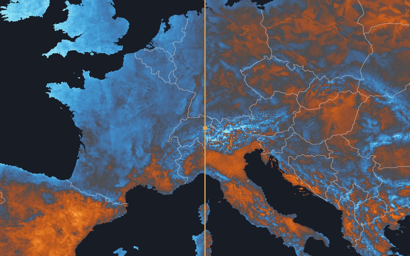
Predicted and Measured
Left of the handle is each cell's summer heat as predicted from its embedding, by a fit that never saw the cell's region. Right of it is the mean daily maximum from June to August as measured. Drag the handle to compare them, and use the buttons to take latitude, then latitude and altitude, out of both.
Every Cell at Once
The scatter plots every land cell's prediction against its measurement. Outside the held-out box over Iberia, the two agree at r = 0.97 as measured, but most of that is the fall in heat from south to north and from the plains up into the mountains, which needs no embedding to know. With latitude and altitude removed the agreement is still r = 0.86, and what is left is the local pattern of coasts, basins and valleys. Brush a patch of the scatter to find its cells on the map.
Some of this agreement was in the embedding before any fit was made, because ERA5-Land temperature was one of AlphaEarth's training targets.
No Single Direction Does This
PC2, the second principal component, follows summer heat at r = 0.70, but nearly all of that is north-south position. With latitude removed it falls to -0.11, where the whole embedding keeps 0.94.
The same is true of tree cover. The single raw axis closest to it correlates with the tree-cover fraction from ESA WorldCover 2021 v200 at r = 0.753. A ridge regression on all 64 axes, predicted for regions it was not fitted on (with no gap left between the fitted and the predicted regions), reaches r = 0.985.
How this was made
Summer heat is the mean daily maximum from June to August in COSMO-REA6, over 150,559 land cells of its 6 km grid. The prediction is a ridge regression on all 64 dimensions of the embedding. Europe is cut into blocks 33 cells on a side and the blocks are dealt into groups. Each group is predicted by a fit on the others, with training cells within 96 km of the group left out. Latitude and altitude are removed with one straight-line least-squares fit over the block cells, and the embedding itself is never adjusted.
A box over Iberia, the Pyrenees and south-west France (with the Balearics and a strip of North Africa) is kept out of every group. One fit on every cell outside the box, none within 96 km of it, predicts its 19,094 cells at r = 0.89 as measured, 0.80 with latitude removed and 0.82 with both removed. The r on the scatter is over the blocks alone.
PC2's figures are over all 150,559 land cells, the box included, with the same straight-line fit taken out of PC2 and the temperatures. Its r of 0.70 has a 95% interval of [0.65, 0.74] from a bootstrap over 234 blocks, since a climate field is autocorrelated and an interval over single cells would be far too narrow. PC1 measures -0.19, weak in either sign (the sign of a principal component is arbitrary).